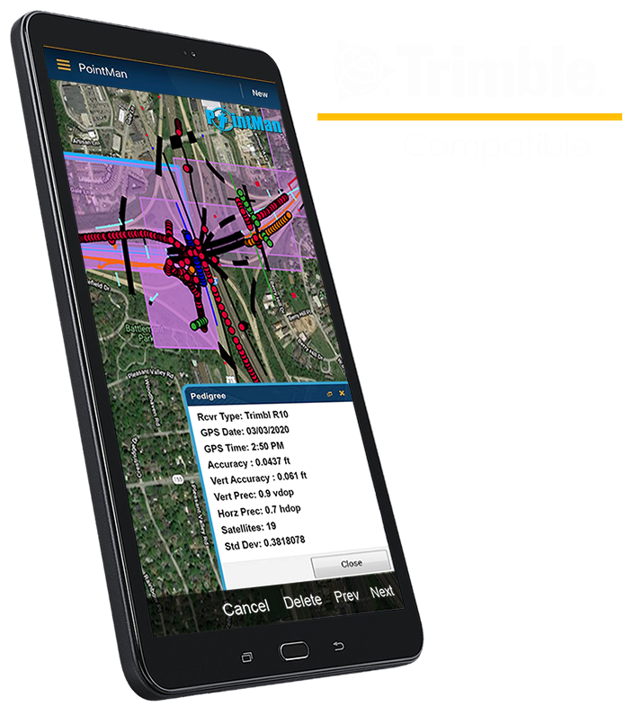
PointMan enables field workers to easily collect, access and visualize information including the type, condition and precise location of utility and infrastrucure assets. This means critical data is readily available when and where it is most needed, which is often on the project site. Using PointMan also means that project data can be digitally captured, recorded, visualized and shared to ensure both project requirements and regulatory standards are achieved by all stakeholders.
Seamlessly Pairs with External GPS/GNSS
Often organizations have unique requirements when it comes to quality levels ranging from mapping grade to Subsurface Utility Engineering (SUE) standards. PointMan can leverage the internal GPS embedded in the mobile devices to capture geospatial location data or when higher levels of precision are required, PointMan is designed to integrate with all major precision GPS/GNSS and RTK receivers.
“Trimble and ProStar have partnered to define the next generation of utility mapping.”
– Stephanie Michaud, P. Eng.
Strategic Marketing Manager
Trimble Inc.
PROUD BUSINESS PARTNER OF TRIMBLE


Designed to Work Offline
Working in the field can often mean working on project sites located in remote areas where cell service can be poor or simply unavailable. PointMan is designed to address these conditions and to work offline. Now you can provide immediate and measurable value anytime and anywhere with the highest level of confidence.
Meets or Exceeds Industry Data Quality Standards
Now you can easily meet industry mapping standards using PointMan. PointMan’s patented Precision & Pedigree data collection processes are designed to meet Subsurface Utility Engineering mapping requirements and comply with US as well as international mapping standards including ASCE 38-02 and CSA S-250-11.
ACCURACY
Supports Survey and Mapping Grade GPS Units
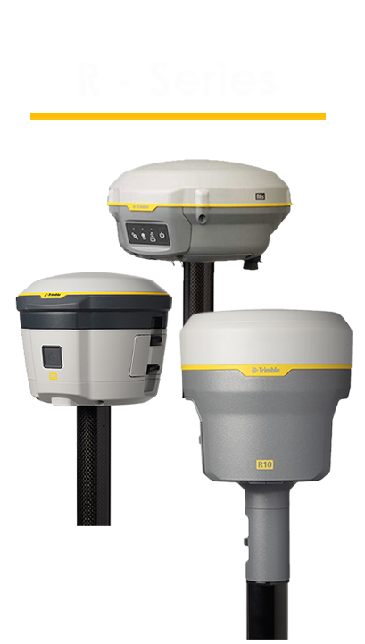
PointMan supports a variety of external GPS devices via Bluetooth to receive higher levels of accuracy: Trimble R1, R2, R8, R8-2, R8-3, R8s, R10, R10-2, R12, R12i, and R12 Lite, SPS985, SPS986, Catalyst DA-1, BlueStar, Emlid Reach, EOS Arrow, and the Juniper Geode.
Multiple VRS/Correction Sources Available
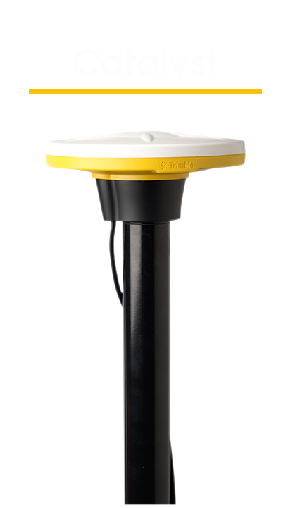
PointMan supports VRS, RTVRN, Base/Rover, and satellite-based Catalyst corrections, granting you access to RTK positioning solutions. Trimble Catalyst provides offline corrections out in the field, with access to RTX positioning services.
Stakeout for Points and Lines
PointMan’s stakeout feature will guide users to the exact location of the selected point or line on the map. For line staking, there are two modes: Nearest and Station. Nearest will take users to the nearest intersection of the selected line, while Station will anchor a point at the distance (entered in by the user) from the selected start point. Stakeout also includes the Cut/Fill values to be used for depth-of-cover surveys.
Real-Time Datum Translations
Users can select a coordinate reference system (CRS) to store data that can be exported with both sets of coordinates (Reference Projection and WGS84) and will line up in other GIS software. PointMan supports custom local projections (.prj), ITRF2014 (all Epochs), and all other standard projections & datums.
Geoid Support
PointMan can convert GPS calculated elevation measurements into four supported elevation Geoid models: EGM96, 12A, 12B, and Geoid18, and lines up properly with other survey-grade project data, features, and line work.
ACCOUNTABILITY
User Information & Location on Every Feature
PointMan’s patented “Precision & Pedigree” technology stores attributes on each feature automatically that include the username of the user who created the feature, the date and time of when the feature was created, as well as the GPS coordinates of the feature and the depth, where applicable.
Stores Attributes for each Point and Line
In addition to user information and location, the pedigree/details panel also lists the GPS receiver, utility locator, CRS, Geoid model, utility codes, Fix Type (correction), PointMan version, mobile device model, as-built information, and antenna height if they were used in the process of collecting the data, as well as all associated accuracy levels, elevations, altitudes, comments, photos/sketches, and forms/PDFs.
Supports PDFs out in the Field
PointMan gives users the ability to create and view PDFs while out in the field. This allows for an increase in accountability and a decrease in liability as field personnel can easily refer to necessary documents from within the app at any location.
Supports Forms out in the Field
PointMan gives users the ability to create and view forms while out in the field. This allows for an increase in accountability and a decrease in liability as field personnel can easily refer to necessary documents from within the app at any location.
Attach Photos and Forms to Any Feature
To help improve the documentation and reliability of collected data, users can attach photos/sketches taken while out in the field as well as Locate Forms that contain the associated One Call Ticket information, requirements, and methods used.
Easily Document As-Built Information
To help improve the reliability of existing sub-surface utility information, users can include as-built information, PointMan documents Quality Level and Antenna Height.
DATA COLLECTION
Collect Multiple Features Simultaneously
Users can pause line collection to collect points, lines, or polygons that are separate from the line-work and add attributes, comments, and symbols to the line vertexes without having to end the line first. This process significantly saves time, effort, and money as it allows you to collect everything in one pass.
Photos & Sketches
Capture photos related to the project(s) right from the mobile device. You can also create sketches of the map and data and even include them as attachments in PDF forms. PointMan allows you to circle items of interest in photos as well as as well as add notes to it. You can export these as photos or PDFs.
Split and Join Lines
Should there be a need to abandon a section of collected line, users can split that line into two and collectively remove the associated points instead of deleting them one by one. Should two lines need to be merged as one, users can do so by using the join feature.
Feature Lock
Feature lock allows users to collect as many data points of the same feature as needed in one go, thus improving efficiency by removing the need to reselect the feature from the New Place Mark dialog each time.
Associate Features to Each Other
Users can associate a photo, file, or feature to another feature. For example, you can associate a valve with a photo taken while out in the field. This allows for better documentation practices and ease-of-use in PointMan.
DATA MANAGEMENT
Export Multiple Formats
PointMan allows you to export data into several different file formats, such as KML, KMZ, CSV, shapefile, PDF, photo, and GDB, via email. These file types work with other GIS mapping software, such as Google Earth and ArcGIS.
KMZ Import
PointMan allows pre-existing data to be imported as a KMZ file with a limit of 20 MB, which will appear as a layer inside of your project(s).
Configurable Data Dictionary
PointMan comes with a default data dictionary of the most common sub-surface utility features. Users looking for components not in the default dictionary can create new components with custom names and attributes.
Supports Custom Attributes
Within the Data Dictionary, users can edit existing components or create new components to include attributes, such as a number or text-based value, the current date and/or time, and the current user, all with a customized labeling capability.
Export at the Project or Feature Level
Users can choose to export an entire project or an individual/group of features, with the associated pedigree, attributes, photos, and PDFs included in the file, into any of the following supported formats: KML, KMZ, Shapefiles, CSV, and GDB, via email. These file types work with other GIS mapping software, such as Google Earth and ArcGIS, allowing you to easily share your data with others and view your data externally.
Capture and Sync Data in Real-Time
PointMan provides real-time communication between the office and the field. This means that as data is being captured and stored by field personnel, it is immediately available to other office and field personnel to assure data quality, identify potential discrepancies and make more timely and informed business decisions.
Compatible with All Major Cable & Pipe Locators
PointMan is designed to integrate with all major manufacturers’ EM locate tools including Radiodetection, Subsite and Vivax Metrotech. This means, you can now electronically capture and record the precise geospatial location of the underground utility and supporting meta-data by simply pairing the EM locate tool to your mobile device.
POINTMAN UPDATES
Version Update – 7.0.0.877
Product Enrichment: PointMan Pro users who upgraded from Plus may continue creating local projects, importing KML/KMZ files to these local projects, as well as exporting the...

PointMan is available in 4 different feature levels – PointMan, PointMan Plus, PointMan Pro, and PointMan Enterprise. Each option offers different levels of data collection features and functionality based on industry standards and user needs.

Features Include:
- Geoid Models
- Google Directions
- Supports PDFs out in the Field
- Data Dictionary
- Photo & Sketch Support
- Pairs with Major Locate Tools
- Export Email, KMZ, Photos, & PDFs


All PointMan Features and:
- Multiple VRS/Correction Services
- Real-Time Datum Translations
- Stakeout for Points & Lines
- Survey & Mapping Grade GPS Units
- Attach Photos & Forms to Features
- Audit Trails for Users & Data
- Feature Lock
- Snap Line work to Points/Potholes
- Split & Join Lines
- Supports Custom Attributes
- Trimble GPS/GNSS & Catalyst DA-1
- Utility Locate Form
- Export Shapefile, KML, & CSV
- Enhanced Export Options
- Import KML & PRJ Files


All PointMan & Plus
Features and:
- Mobile & Cloud
- Site Calibration
- Work Offline
- One Call Tickets
- Shared Cloud for Multiple Users
- Manage User Permissions & Roles
- In App Support
- Service Level Agreements
- Online Help & Feedback
- Attach Photos & Forms to Any Feature
- Audit Trails for Users & Data
(Activity Logs)


All PointMan, Plus & Pro
Features and:
- Volume Pricing
- API Access
- 3rd Party Integration (CAD/GIS/Survey)
- Beta Test New Features
- Custom PDF Forms
- Dedicated Priority Support
- Infield Training Included
- Trimble FXL Import


