
על ידי מתיו ברמן | יול 17, 2024 | הבלוג של PointMan
One of the most significant challenges of maintaining underground utilities is their invisibility. Unlike above-ground infrastructure, buried utilities are hidden from view, making it difficult to know their exact locations. This lack of visibility can result in...

על ידי מתיו ברמן | יול 4, 2024 | הבלוג של PointMan
Construction delays can be a significant challenge for any project. They lead to increased costs and extended timelines and can often cause frustration among stakeholders. One major cause of these delays is the unexpected encounter with underground utilities. Without...
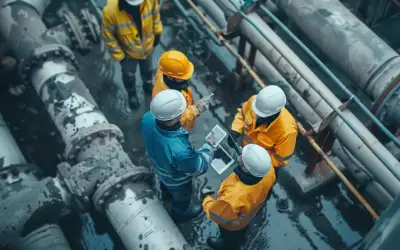
על ידי מתיו ברמן | יול 4, 2024 | הבלוג של PointMan
Effective management of water utility assets is crucial for the smooth functioning of any community. Water utility asset management involves tracking and maintaining the infrastructure that delivers clean water to homes and businesses. This includes pipes, pumps,...

על ידי מתיו ברמן | יונ 27, 2024 | הבלוג של PointMan
Sustainable development is the practice of meeting present needs without compromising the ability of future generations to meet their own needs. It emphasizes the importance of balancing economic growth, environmental protection, and social well-being. As...

על ידי מתיו ברמן | יונ 26, 2024 | הבלוג של PointMan
Today, with the world’s structural composition advancing at an incredible pace, knowing what lies beneath the surface is crucial. Imagine planning a construction project. Without accurate mapping, you risk hitting a gas line or disrupting electrical cables....

על ידי מתיו ברמן | יונ 25, 2024 | הבלוג של PointMan
Urban planning is the process of designing and organizing cities, towns, and communities to make them more livable, efficient, and sustainable. It involves making decisions about where buildings, roads, parks, and other infrastructure should be located and how they...


תגובות אחרונות