חלון דיאלוג
Underground utility mapping software

PointMan זמין להורדה בחינם ב-Google Play וב-Apple Store


Underground utility mapping software
970-242-4024 | כניסה למשתמשים מקצועיים
PointMan
  • תכונות
  • הענן שלנו
  • תאימות
    • GPS/GNSS
    • מאתרים
    • מכשירים ניידים
    • ג'אבד
    • לייקה
    • טרימבל
  • תעשיות
    • בנייה
    • עירוני
    • סו
  • תמחור
  • ProStar®
  • סוחרים
  • תמיכה
    • אוניברסיטת PointMan
    • הפעל את PointMan
    • משאבי טכנולוגיה
    • שאלות נפוצות
    • סרטונים/בלוג
    • מדריכים
    • צור קשר
    • שירות לקוחות
בחרו עמוד
Labels & Leaders: Enhanced CAD Tools

Labels & Leaders: Enhanced CAD Tools

על ידי מתיו ברמן | יול 15, 2021 | הבלוג של PointMan, PointMan Updates

Several months ago, ProStar released its newest software offering, PointMan Pro (PMP). This software allows for customization and possibilities of additional features for clients. Our developers have diligently worked to implement Pro’s newest feature to enhance our...
PointMan Integration with Trimble GPS / GNSS Systems

PointMan Integration with Trimble GPS / GNSS Systems

על ידי מתיו ברמן | יונ 25, 2020 | הבלוג של PointMan

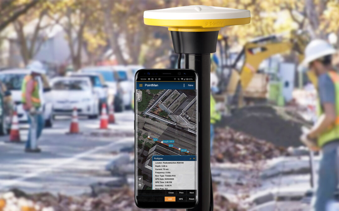
PointMan Mobile App Integration with Trimble GPS / GNSS Systems and Trimble Catalyst GNSS Subscription Services Summary The Trimble Precision SDK (TPSDK) is an application interface that allows developers to integrate Trimble hardware technology into their own...
Why Municipalities Want Better Maps: A White Paper

Why Municipalities Want Better Maps: A White Paper

על ידי מתיו ברמן | מאי 4, 2020 | ללא קטגוריה, הבלוג של PointMan

By Steve Slusarenko Mapping is one of the earliest technologies known to man. The oldest known permanent maps are dated from 14,000 BCE and perhaps earlier.[1]  Maps are a powerful communication tool that allows the map user to orient themselves to features that are...
Snapping Linework to Potholes in the Field

Snapping Linework to Potholes in the Field

על ידי מתיו ברמן | פבר 12, 2020 | הבלוג של PointMan

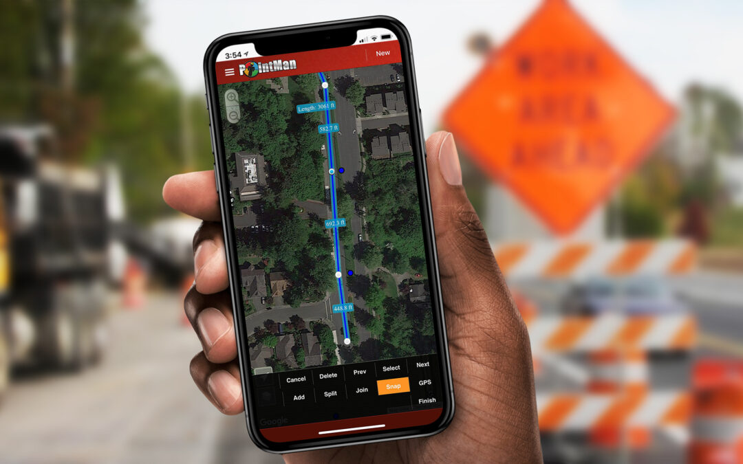
GIS data rarely lines up with the real-world location of a utility line. This type of issue is especially common in the construction industry. “Potholing” is a term commonly referred to as the process of verifying the location of buried utilities by hydro-vacuuming...
Ground-breaking initiative by Colorado DOT

Ground-breaking initiative by Colorado DOT

על ידי מתיו ברמן | אוק 29, 2019 | הבלוג של PointMan

Ground-breaking initiative by Colorado DOT for capturing and sharing location of underground utilities According to the Federal Highway Administration (FHWA) missing or inaccurate location information about underground utilities is a major source of highway...
ProStar Delivers One Call Online Ticket Request App

ProStar Delivers One Call Online Ticket Request App

על ידי מתיו ברמן | ספט 23, 2019 | הבלוג של PointMan

ProStar delivers reliable, easy to use, One Call online ticket request application The impact of a US State One Call Center deploying an online ticket request application developed by ProStar was felt almost immediately. Within days of the initial deployment, home...
הרשומות הבאות »

פוסטים אחרונים

  • RD8200SG – מדריך להתאמת Bluetooth ב-iOS עם PointMan
  • כיצד תוכנה למיפוי תשתיות תורמת לתעשיית הנפט והגז: יישומים למהנדסי צנרת וצוותי תחזוקה
  • שיפור ההדמיה של תשתיות: טכניקות להבנה טובה יותר של תשתיות תת-קרקעיות
  • היתרונות של גישה לנתוני תשתיות בזמן אמת עבור מודדים ומהנדסים: שיפור קבלת ההחלטות בשטח
  • כיצד להגן על תשתיות תת-קרקעיות במהלך הבנייה

תגובות אחרונות

    עדכונים

    הפעל

    טבלת תאימות

    • עקבו
    • עקבו
    • עקבו

    חדשות

    פטנטים

    צוות

    סוחרים

    הצעת RD

    פרטיות

    ProStar

    קריירה

    צור קשר

    הצטרפו לרשימת התפוצה שלנו

    "*" מציין שדות חובה

    שדה זה מיועד לאימות ויש להשאיר אותו ללא שינוי.
    שם
    אתר זה מוגן על ידי reCAPTCHA ו-Google מדיניות פרטיות ו תנאי השימוש להגיש בקשה.

    © 2026 ProStar Geocorp® | כל הזכויות שמורות

    Hebrew
    English Arabic French German (Austria) German (Formal) Kazakh Spanish Swedish